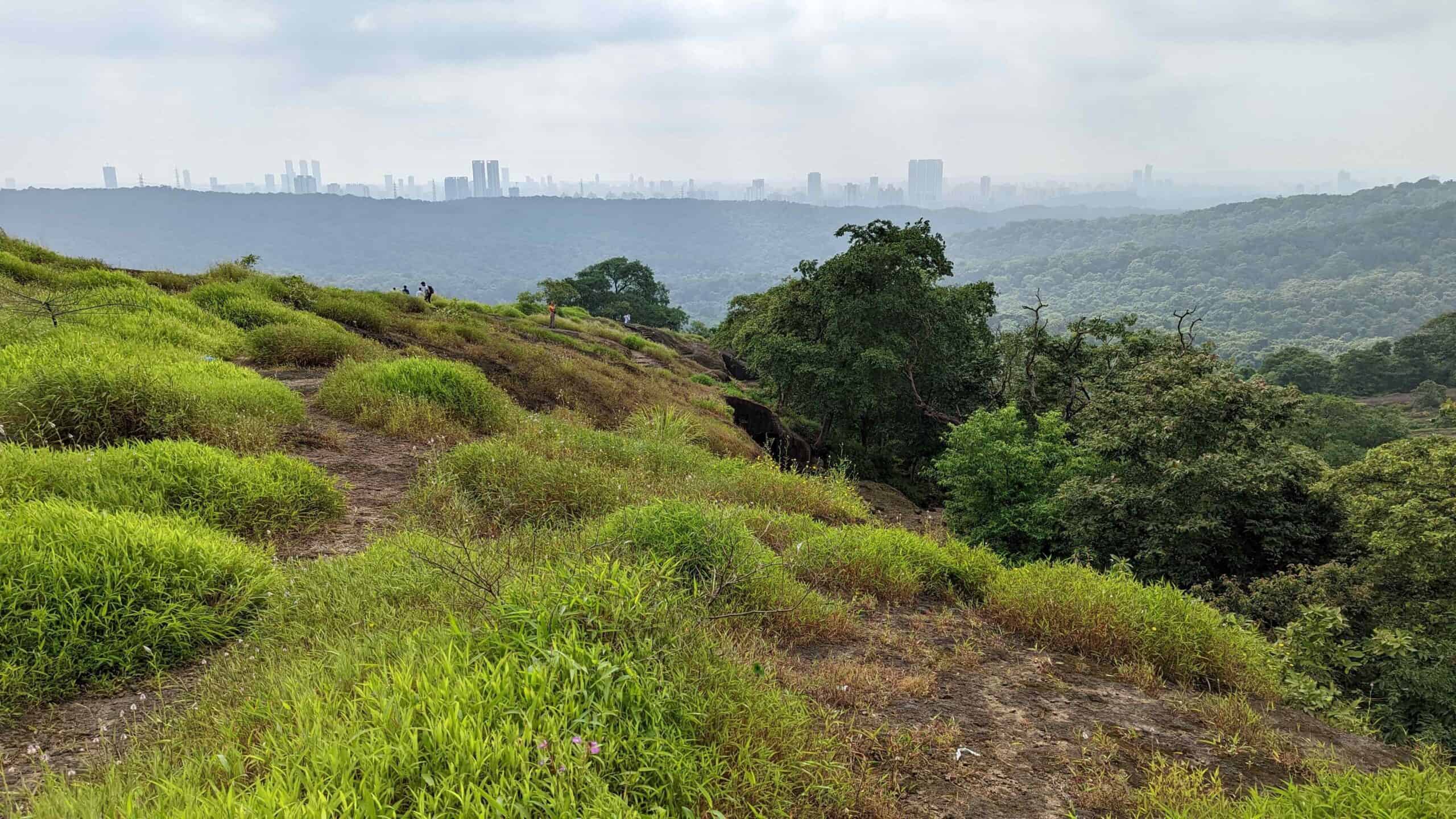
19 Amazing Hikes In Mumbai
Are you looking for hikes in and around Mumbai? Read on! Mumbai and its outskirts have lots of trails that not only provide a break from the urban chaos but also offer amazing views and a chance to explore the nature and history of the area.
Mumbai, being in the vicinity of the beautiful hills of the Western Ghats (Sahyadris) especially has access to beautiful hikes to hilltop forts of the 17th, 18th century Maratha empire littered across Maharashtra.
I love to hike or as Indians say, trek, and when I lived in Mumbai I found myself craving some time in nature to escape the city. The trekking season is usually during the monsoon months of June – August or December – February when the weather is not harsh.
I highly recommend the first two hikes on the list: Kanheri Caves Trail and Shilonda Trail. They are both in Sanjay Gandhi National Park (located within Mumbai) and not too difficult.
19 Amazing Hikes in Mumbai
Here’s a list of the best hikes in and around Mumbai, with treks for both experienced hikers and beginners.
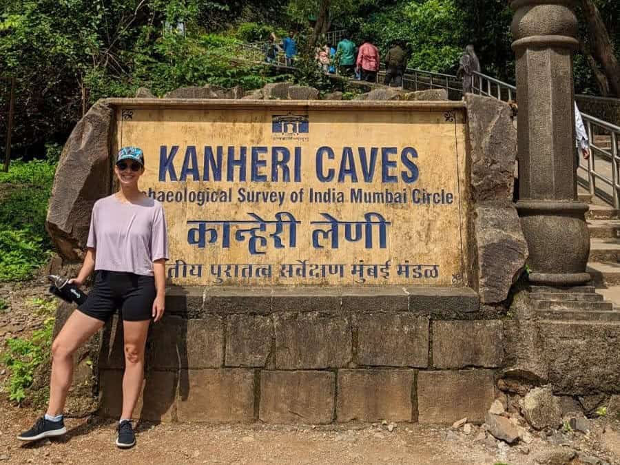
1. Sanjay Gandhi National Park – Kanheri Caves Trail
Location: Borivali East, Mumbai
Distance from Mumbai: Within Mumbai
Difficulty level: Easy to Moderate
Distance: Approximately 6 km (Round trip)
Best Time to Visit: October to March
Within the Sanjay Gandhi National Park, the Kanheri Caves trail offers an easy hike leading to a complex of ancient Buddhist caves dating back to the 1st century BCE.
It’s a perfect blend of nature, history, and spirituality. Visitors also get a chance to see the park’s diverse flora and fauna, including the occasional spotted deer or monkey.
A visit to the Kanheri Caves is an easy way to get in some steps without leaving the city. There are only a handful of neighborhoods that are good for enjoying leisurely walks in Mumbai.
2. Sanjay Gandhi National Park – Shilonda Trail
Location: Borivali East, Mumbai
Distance from Mumbai: Within Mumbai
Difficulty level: Easy
Distance: 2.5 km loop
Best Time to Visit: October to March
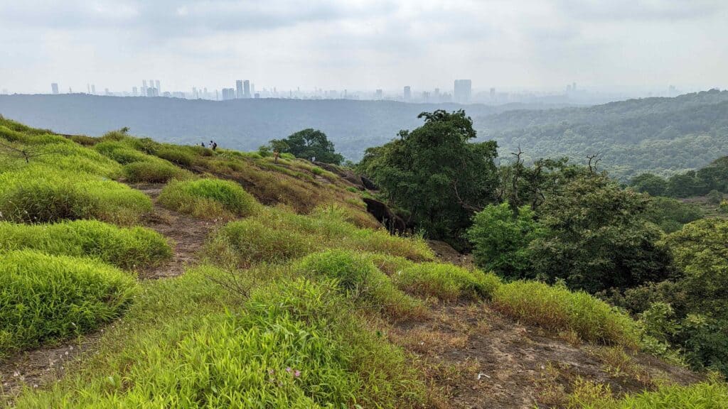
If you’re craving a bit more nature within the Sanjay Gandhi National Park, the Shilonda trail loop offers an easy hike through an enchanting forest. You will probably see leopard pugmarks and deer. This trail also gives you the opportunity to see old tribal settlements that have been reclaimed by nature. Depending on trail conditions, you can see one, two or three streams and if you’re lucky go all the way to a waterfall.
It’s a perfect escape into nature in the heart of Mumbai. The trail is open to trekkers from 7am to 6pm with a nature trail fee payable in the park. You can also book a guided trek on this website.
3. Trek to Karnala Fort
Location: Karnala Bird Sanctuary
Distance from Mumbai: ~48 km
Difficulty: Moderate
Distance: 3 km (One way)
Best Time to Visit: June to September (Monsoon) for lush landscapes; October to March for clear skies
Karnala Fort is located on top of what locals call the ‘thumb hill’ and has two forts. It is within the Karnala Bird Sanctuary, which is ideal for a day trip from Mumbai. The path, surrounded by greenery and home to various bird species, leads to an ancient fort at the top. It was of extreme strategic importance as it overlooks the Bor pass, which connects the Konkan coast to the interior of Maharashtra.
The panoramic views of the surrounding mountains and the bird sanctuary from the fort are mesmerizing. The trek is relatively short but can be slippery during the rains, so be sure you have proper trekking shoes.
4. Trek to Harishchandragad via Pachnai
Location: Ahmednagar District
Distance from Mumbai: ~140 km
Difficulty: Moderate to Difficult
Distance: 9km out and back from Pachnai
Best Time to Visit: October to March
Harishchandragad is a 6th century fort that is a popular trekking destination known for its scenic beauty, challenging terrain, and the ancient Kedareshwar Cave. With ~1800 ft of elevation gain, this trek is not for the casual hiker. The trek via Pachnai is the easiest route, making it accessible to a wider range of hikers.
Once at the top, the view of the Konkan Kada, a concave cliff, and the Taramati peak, the second highest peak in Maharashtra, is breathtaking. The area is steeped in history, with temples and fortifications.
5. Rajmachi Fort Trek
Location: Between Lonavala and Karjat
Distance from Mumbai: ~80 km to Lonavala, ~60km to Karjat
Difficulty: Easy to Moderate
Distance: 22 km out and back from Lonavala, 9km out and back from Karjat
Best Time to Visit: June to September for the monsoon experience; October to March for cooler weather
The trek to Rajmachi Fort is one of the most picturesque trails in the Western Ghats, offering stunning views of the Sahyadri mountains. The fort consists of two citadels, Shrivardhan and Manaranjan forts, and is surrounded by a wide plateau.
The trek can be accessed via both Lonavala and Karjat, with the Lonavala path being longer but easier. It passes through dense forests, waterfalls, and small villages. It’s an excellent overnight trek, with camping options available near the fort. The hike is known for its fireflies that flock to the fort in the evenings!
6. Trek to Visapur Fort
Location: Near Lonavala
Distance from Mumbai: ~95 km
Difficulty: Moderate
Distance: 5 km (One way)
Best Time to Visit: June to September for the lush monsoon scenery; October to March for clear views
Visapur Fort trek is a monsoon favorite, offering a path that becomes a small waterfall during the rains. The trek is moderate, with stone-paved steps leading to the top.
The fort provides a panoramic view from atop the plateau of the surrounding landscape, including a breathtaking view of its twin fort, Lohagad. The ruins of the fort, including large gates, old houses, and water cisterns, make it a fascinating visit for history buffs.
7. Trek to Lohagad Fort
Location: Near Lonavala
Distance from Mumbai: ~95 km
Difficulty: Easy
Distance: 5 km one way
Best Time to Visit: Monsoon for the vibrant landscape; all year round
Lohagad fort is one of the most popular monsoon treks around Mumbai. It is a 2000 year old dual fortified fort with amazing 360 degree vistas of the Sahyadri mountains and a vast plateau. In heavy rains, the 300 steps leading up to the fort become a mesmeric waterfall.
This fort offers a criss-crossing path up to it in dense vegetation with largely intact walls and gates, offering an enchanting mix of history and nature for trekkers.
8. Lion’s Point to Tiger Point trek
Location: Near Lonavala
Distance from Mumbai: ~95 km
Difficulty: Very Easy
Distance: 1 km
Best Time to Visit: Monsoon for the vibrant landscape; all year round
Lion’s point and Tiger point are two popular spots in Lonavala / Khandala. These offer panoramic views of the Sahyadris and the many waterfalls that emerge during the monsoons. These spots are also popular for their food stalls, which offer everything from Maggi to vada pav to tea and coffee.
You can drive to both these points but an easy walk between these points offers some peace, quiet and views.
9. Trek to Duke’s Nose
Location: Khandala
Distance from Mumbai: ~95 km
Difficulty: Moderate
Distance: 9km out and back
Best Time to Visit: Monsoon for the vibrant landscape; all year round
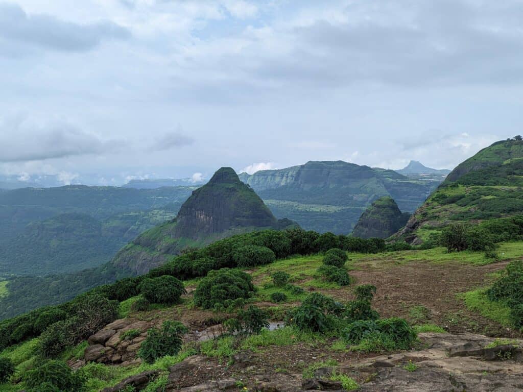
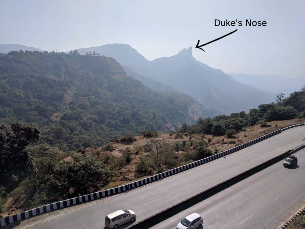
Earlier known as Naghpani which means the hood of a snake, this trek is now known as Duke’s nose after Duke Wellington. This is a popular trek for rappelling, rock climbing and camping. It is also a prominently visible feature from the Mumbai – Pune expressway.
The outcrop of the mountain is steep but the mountain top itself is flat which offers a lot of space to camp or picnic up there!
10. Bhimashankar Temple Trek via Shidi Ghat
Location: Bhimashankar Wildlife sanctuary
Distance from Mumbai: ~190 km
Difficulty: Moderate
Distance: 12 kms
Best Time to Visit: Monsoon for the vibrant landscape; all year round
If you are a nature buff and looking for something more adventurous, Bhimashankar Wildlife sanctuary offers you a host of trails. A popular, usually overnight trek takes you to the heart of Bhimashankar Wildlife Sanctuary through enchanting subtropical forests, waterfalls and streams.
The hike involves hiking along a ladder route and it is recommended that you book with a guided tour company. The nearest town is Neral and the base village for the trek is Khandas.
11. Trek to Tikona Fort
Location: Near Kamshet
Distance from Mumbai: ~120 km
Difficulty: Easy to Moderate
Distance: 3.5 km out and back
Best Time to Visit: Monsoon for lush scenery; all year round
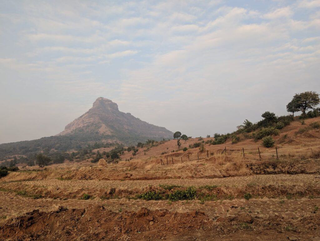
Tikona peak or fort, also known as Vitangad is a spectacular fort at an elevation of about 3,600 ft. Tikona means triangle and the peak offers spectacular panoramic views from atop this triangular feature. Some of the structures at the fort date back to the 7th century, offering a glimpse into the rich history of the area.
This short, moderately difficult hike can be combined with a visit to the picturesque Pawna lake and dam. The nearby town of Kamshet itself offers a good getaway, with a host of recreational activities and nature spots.
12. Trek to Korigad Fort
Location: Near Aamby Valley or Lonavala
Distance from Mumbai: ~105 km
Difficulty: Easy from Aamby Valley, Challenging from Lonavala
Distance: 1km out and back from Aamby Valley, 6 kms loop from Lonavala
Best Time to Visit: Monsoon for the misty landscape; all year round
Korigad fort is another popular hilltop fort near Lonavala. You have the option of starting near Aamby valley for a short and easy climb up to the vast table top fort. If you are up for a challenge, start lower down in Lonavala for a long, challenging climb.
In the monsoon months, the vast table top features at the peak offer a spectacular, lush, green and meadow-like misty landscape. Since this is extremely popular, you will encounter trekkers and picnickers along your path and at the top.
13. Trek to Mahuli Fort
Location: Asangaon
Distance from Mumbai: ~70 km
Difficulty: Moderate to Difficult
Distance: 6 km one way
Best Time to Visit: Monsoon for waterfalls; October to February for pleasant weather
Mahuli peak at 2815 ft is the highest point in the Thane district, giving it the nickname ‘Everest of Thane’. This trek is often considered a paradise for rock climbers and gives trekkers diverse landscapes from meadows to pinnacles. There are many pinnacles for rock climbers to scale and the popular ones include Vazir, Vishnu, Navra, Navri, Mahuli-Chanderi. The carved rock and mountain features around Mahuli give it an almost subtropical Monument valley like vibe.
This area is also part of the Tansa wildlife sanctuary and gives you the opportunity to scour some unique flora and fauna. It also has a star gazing site that can be accessed near the trail at Koti Plateau.
14. Trek to Sudhagad Fort
Location: Pali
Distance from Mumbai: ~100 km
Difficulty: Moderate
Distance: 9 km round trip
Best Time to Visit: Monsoon for greenery; October to March for cooler temperatures
Sudhagad is a small hilltop fort near Pali in Maharashtra. The fort itself dates back to the 2nd century BC and before Raigad, was considered the capital of the Maratha empire by Shivaji, the foremost Maratha King. The fort offers the unique experience of 2 large lakes at the peak, where one can take a refreshing dip.
This trek involves some hiking along ladders and is a bit technical. There is also an alternate route to descend to Dhondase village from where you can hire a car or a rickshaw back to Pali.
15. Trek to Matheran or Garbett Point Trek
Location: Matheran
Distance from Mumbai: ~85 km
Difficulty: Moderate
Distance: 6 km one way from Diksal
Best Time to Visit: Monsoon for the waterfalls; all year round for pleasant weather
Matheran is an iconic hill station, not just in Maharashtra, but all over India. It is 8 square kilometers of an automobile-free zone which makes it a uniquely tranquil spot very close to the bustling city of Mumbai. A popular way of getting to Matheran is via the Neral-Matheran narrow gauge train line or lovingly called the ‘toy train’ which winds through the picturesque Sahyadris.
The trail itself runs along the Garbett plateau and is beautiful all year round. The trail begins in Diksal village near the Tatoba temple and ends in Matheran. So it is advisable to have transport booked from Matheran to take you back to your parking spot.
16. Trek to Alang, Madan, and Kulang (A-M-K) Forts
Location: Nashik District
Distance from Mumbai: ~180 km
Difficulty: Very Difficult
Distance: Varies, usually at least a 2 day trek
Best Time to Visit: October to March for clear skies and cooler temperatures
This trek is not for the faint hearted but is probably the most rewarding and difficult trek in Maharashtra. This trek takes you through dense forest trails, exposed rock ledges, vertical rock faces requiring technical hiking with ropes, water cisterns atop the forts and of course, unendingly beautiful scenery.
Due to the long, technical nature of the hike and the many base villages you can choose to start or end this hike, it is recommended you do not do this solo and plan everything in advance. Make sure you have experienced hikers on this route in your group or hire local guides.
The most common route for this trek is Ghatgar to Kurungwadi. You could also start at Udawane for a shorter trek but no matter what route you take, this is a 2 day trek. You will also see Bhandardara, Maharashtra’s highest point during this hike.
17. Trek to Prabalgad Fort
Location: Near Panvel
Distance from Mumbai: ~50km
Difficulty: Moderate
Distance: 3 km one way
Best Time to Visit: Monsoon for lush views; October to March for milder weather
This short but moderate hike is a perfect getaway if you are looking for something close to Mumbai. The Prabalgad fort is prominently visible from the Mumbai-Pune expressway on the Vashi to Panvel stretch. The starting point of this hike is Thakurwadi village, right after the Schedung Phata in Panvel.
The fort timings are 6am to 5pm and there is a Rs. 20 entry fee with parking available at the base. The entire trek can take 5-7 hours depending on your fitness level, with the ascent taking 3-4 hours.
18. Andharban Jungle Trek
Location: Pimpri, Tamhini Ghat
Distance from Mumbai: ~130km
Difficulty: Moderate
Distance: 11 km one way
Best Time to Visit: Monsoon for the dense fog and greenery; July to September
Andharban means ‘dense dark forest’ and this hike is considered one of the must dos in Maharashtra, especially during the monsoon months. This hike starts at 2100 ft and descends into a valley. The first 7-8 kms of the hike are through dense evergreen trees, enabling you to be enchanted by the wonders of a subtropical, lush, monsoonal forest.
It then takes you through 3 river streams and a beautiful village called Hirdi with friendly locals where you can fill yourself with a delicious lunch. You then continue on to Bhira dam along the origin of the Kundalika river, famous for white water rafting and other adventurous activities. You then walk about 5 kms to reach the base of the trek. Given the nature of the hike, it is recommended you book with a trekking company so that you can be picked up at the base.
19. Trek to Ratangad Fort
Location: Ratanwadi village
Distance from Mumbai: ~175km
Difficulty: Moderate to Difficult
Distance: 9.5 km out and back
Best Time to Visit: Monsoon for the waterfalls and greenery; October to December for clearer paths
Ratangad fort is part of the Kalsubai range, which has some of the highest peaks in the Sahyadris. The fort itself offers spectacular views of the surrounding peaks and the Bhandardara dam. This trek also offers the option of camping inside caves, if you are eager to make this a two day experience.
The trail itself is fairly flat with slight ascents until you hit the base of a hill, after which there is a steep 45 minute ascent to a clearing followed by another 30-40 minute ascent through a forest. Since the trail has forest cover, it remains cool even in the summer months. The final section of the trail involves 4 steel ladders over 15-30 minutes that take you to the top.
Important Tips for Hikes in Mumbai
✅ Preparation is Key: Research your chosen trail well, understand the difficulty level, and prepare accordingly.
✅ Stay Hydrated: Carry enough water and snacks as the hiking trails usually do not have potable water available.
✅ Wear Appropriate Gear: Good, anti-slip trekking shoes, comfortable clothing, and rain gear (during monsoon season).
✅ Respect Nature: Do not litter! Leave the trail as you found it.
✅ Safety First: Always inform someone about your trekking plans and estimated return time.
TLDR: Amazing Hikes In Mumbai
Exploring these trails offers a break from Mumbai’s chaos, connecting you with nature and history in a unique way. Whether you’re seeking an easy hike or an experienced trekker looking for a challenge, the areas around Mumbai offer something for everyone. Happy hiking!

